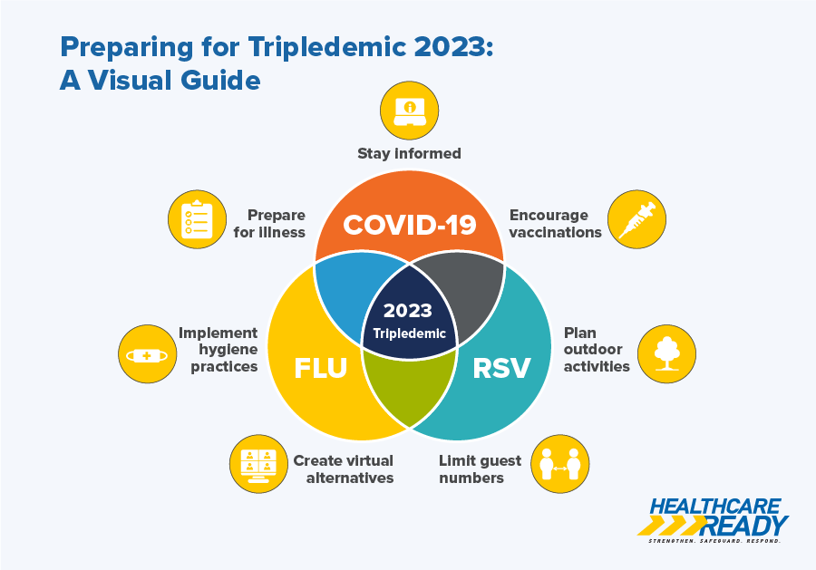
Mapping the United States' Response to the Novel Coronavirus (SARS-CoV-2) Pandemic
Situational awareness is key for responding to any disaster. But situational awareness gets complicated during pandemics like novel coronavirus disease (COVID-19), where the situation not only changes constantly, but it impacts entire continents at a time.
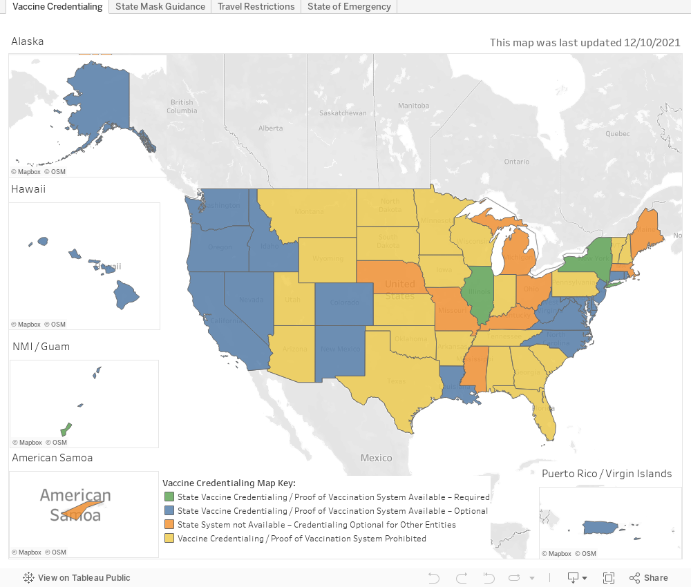
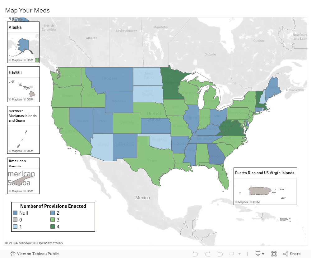
That’s why Healthcare Ready has created the interactive US Measures and Travel Restrictions Map.
Our map tracks state and local movement and travel restrictions and health and emergency provisions for COVID-19 to provide important situational awareness for businesses, especially healthcare distributors and healthcare providers, as well as public emergency responders. Knowing what measures are in place in each state helps these groups move critical products – like masks and medicines – and response personnel efficiently in and out of states and counties. The end goal? To keep the residents of those states safe and healthy and to limit interruption of their medical care throughout the pandemic.
Users can interact with the map to find information on states’ measures in response to COVID-19 that may impact their organization’s operations.
The US map tracks:
- State-level states of emergency (SoEs)
- State-level public health emergencies (PHEs)
- Major containment/quarantine zones
- State-level access and re-entry programs
How to Use the Map
Hover over a state or territory to view additional details about the state’s measures, including whether it has a formal access and re-entry program.
Click on a state to access links to the state’s applicable measures. If a state has an SoE, PHE, or an access and re-entry program in place, links to those measures will be displayed when the state is clicked.
US Exit and Re-Entry Tracker
US Pharmacy Provisions
Stay up to date with Healthcare Ready:
To stay up-to-date with our new tools and analysis for COVID-19, sign up to receive Healthcare Ready Alerts.